
Electrofishing
Redd Counts
Scale Reading
Population Surveys
Fishing with electricity is the most common method employed to survey a river dwelling fish species. Back-pack electro-fishing equipment was utilized during the electro-fishing surveys. Fully quantitative surveys, Time Delineated surveys and semi quantitative surveys are carried out and recorded in accordance with the protocols established by the Scottish Fisheries Co-ordination Centre (2007).
- Timed Surveys: Where a large catchment area needs to be covered, a quick, timed electrofishing survey method allows more sites to be sampled per day. Using a standard method may allow samples to be compared, for instance, for species distribution over a whole catchment. All sites are fished for approximately 10 minutes total time but the equipment used incorporates a timer when the anode is live allowing for an accurate measure of time actually fished. We aim to complete three minutes actual electrofishing time at each site, and the results are expressed as number of fish caught per minute active electrode time. Staff work in an upstream direction fishing mainly run and riffle habitats. Any eels seen are counted. All fish are lightly anaesthetised using a solution of MS222, species identified and a length measurement taken.
- Fully Quantitative Surveys: During each survey, where possible areas of river/burn (approximately 100m2) are isolated by placing stop-nets at the upstream and downstream extent of the area to be fished in order to prevent fish from evading capture and escaping from the area. The area is fished through in a methodical and thorough manner with fish being retained in buckets. Captured fish are lightly anaesthetized in order to facilitate accurate length measurements (mm) and species identification. The area is fished through a second and third time in an attempt to remove the majority of fish from the area and to provide a depletion curve for each fish species. By applying stream dimensions such as wetted area along with numbers of fish captured in successive fishing runs to a statistical formula, an estimate into fish density (number of fish/100m2) can be calculated. Where fish numbers are very low, or depletion is not observed between runs, a minimum estimate is calculated which is the total number of fish caught divided by the area fished and is expressed as number of fish per 100m2.
- Semi-Quantitative Survey: At each survey a site an area of approximately 100m2 is identified. No stop nets are used. The site is then fished in a methodical manner in an upstream direction. Captured fish are lightly anaesthetized, species identified and lengths recorded. The site is fished through once only and densities recorded as a minimum density estimate – number of fish per 100m2.
On the Ness catchment there are a number of index sites that are routinely monitored on a yearly basis, these form part of our core monitoring programme and give us an indication of the status and distribution of fish species within the catchment. On top of this we aim to carry out surveys throughout the whole area with the aim of covering as much ground as possible. Time and staff constraints along with weather conditions often hamper the exercise, however, we have built a good dataset over the years.

20220803_115752
Arctic charr juvenile (top) alongside the more common brown trout fry
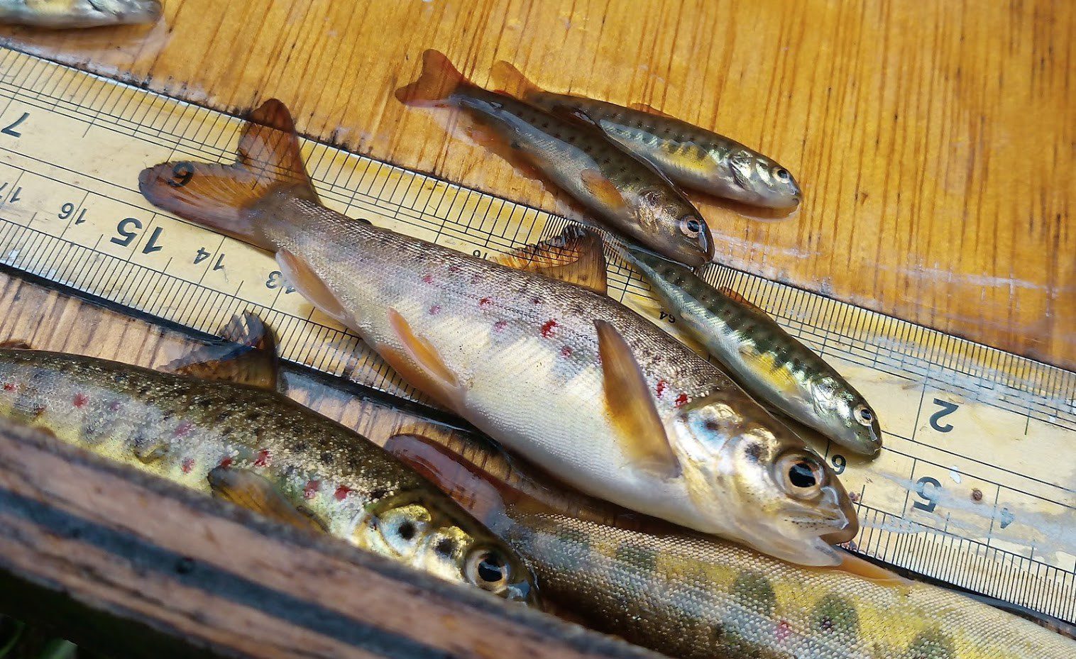
Ness Parr

Brown Trout
Data Analysis
In the absence of a national classification scheme the data obtained from time delineated surveys is compared to the Spey Classification and River ranking system. This enables staff to obtain a comparable data set and give an indication of the status of fish populations within the Ness system, Area Delineated surveys are classified under the SFCC Moray Firth region and corrected for stream width, and more recently by comparison with the predicted benchmark for that location Discussion – National Electrofishing Programme for Scotland (NEPS) 2021: analysis – gov.scot (www.gov.scot)